
Field Trip to Api-Api
On 22 October 2017, a field trip was organised for students taking the modules AV-4302/AW-4310 Wetland Ecology and Management and AV-2201/AW-3308 Introduction to Remote Sensing. 140 undergraduate students participated in this outing organised by the course lecturer Dr. Shafi Noor Islam.
|
Api-Api wetland is located near Meragang Beach, west of Muara-Labuan Ridge and Tanjong Batu in Brunei Muara District. It is in the catchment area of the Pemburungunan River with an area of 53 hectares. Due to the area being close to the coast and the sea, an intertidal zone, only one specific type of forest can survive in wet and saline conditions: the mangrove forest. However, the mangrove forest of the Api–Api wetlad is known to have diminished when it was submerged when the water level in the tidal plain was higher than normal because of several geological and environmental factors. Only mangrove can survive in the wetland due to its location on the coast near to the sea. Sea water can move into the river during high tides or extreme conditions such monsoons, and this causes the water and soil to be saline and acidic. Several species of mangrove can be found in the Api-Api wetland, including Rhizophora mangle, Brugulero, Nypa fruticans, Lumnitzero, and especially Avicennia marina, which can be found in abundance only in the middle of the wetland, though some can also be found on the banks of the Pemburungunan River. Avicennia marina can grow well in a highly saline water condition as it is able to withstand water salinities of up to 83 ppt. The water-logged soil condition in the wetland would exhibits gaps exchange (respiration) of the roots as aeration of the soil is poor. |
 |
The following activities were done by the students:
- special lecture on the history and geology of the site and wetland development in the area
- investigation and walking along the banks of the Api-Api wetland area
- observation of the changing patterns of land use and land cover
- study of the beach area and its protection and development
- investigation of the Api-Api wetlands and the connectivity of the rivers with the South China Sea
- inspection of the present development and construction activities in the coastal and forest wetland areas
- observations centered on the ecological threats of the Api-Api wetland areas: where are the main threats for integrated and sustainable management of the wetlands ecosystem in the coastal areas in Brunei Darussalam?
- for the Remote Sensing students, the main task was to investigate changing patterns of vegetation and coastal landscapes

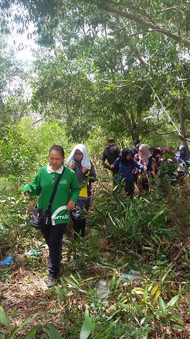
Students walking along the beach with huge Acacia trees in the background.
The Api-Api wetlands area in the coastal region of Brunei. Acacia trees (Acacia cincinnata) are gradually establishing an acacia forest.

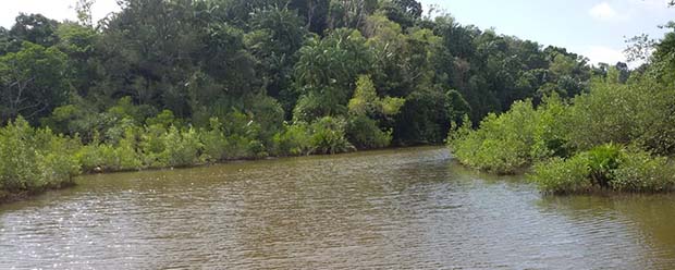
The Api-Api wetland area.

Students listening to the lecture by Dr Shafi.